File:Roanoke Island.jpg
Jump to navigation
Jump to search
Size of this preview: 800 × 509 pixels. Other resolutions: 320 × 204 pixels | 640 × 407 pixels | 1,024 × 652 pixels | 1,280 × 815 pixels | 2,560 × 1,629 pixels | 3,600 × 2,291 pixels.
Original file (3,600 × 2,291 pixels, file size: 6.8 MB, MIME type: image/jpeg)
Captions
Captions
Add a one-line explanation of what this file represents
Summary
[edit]| Description |
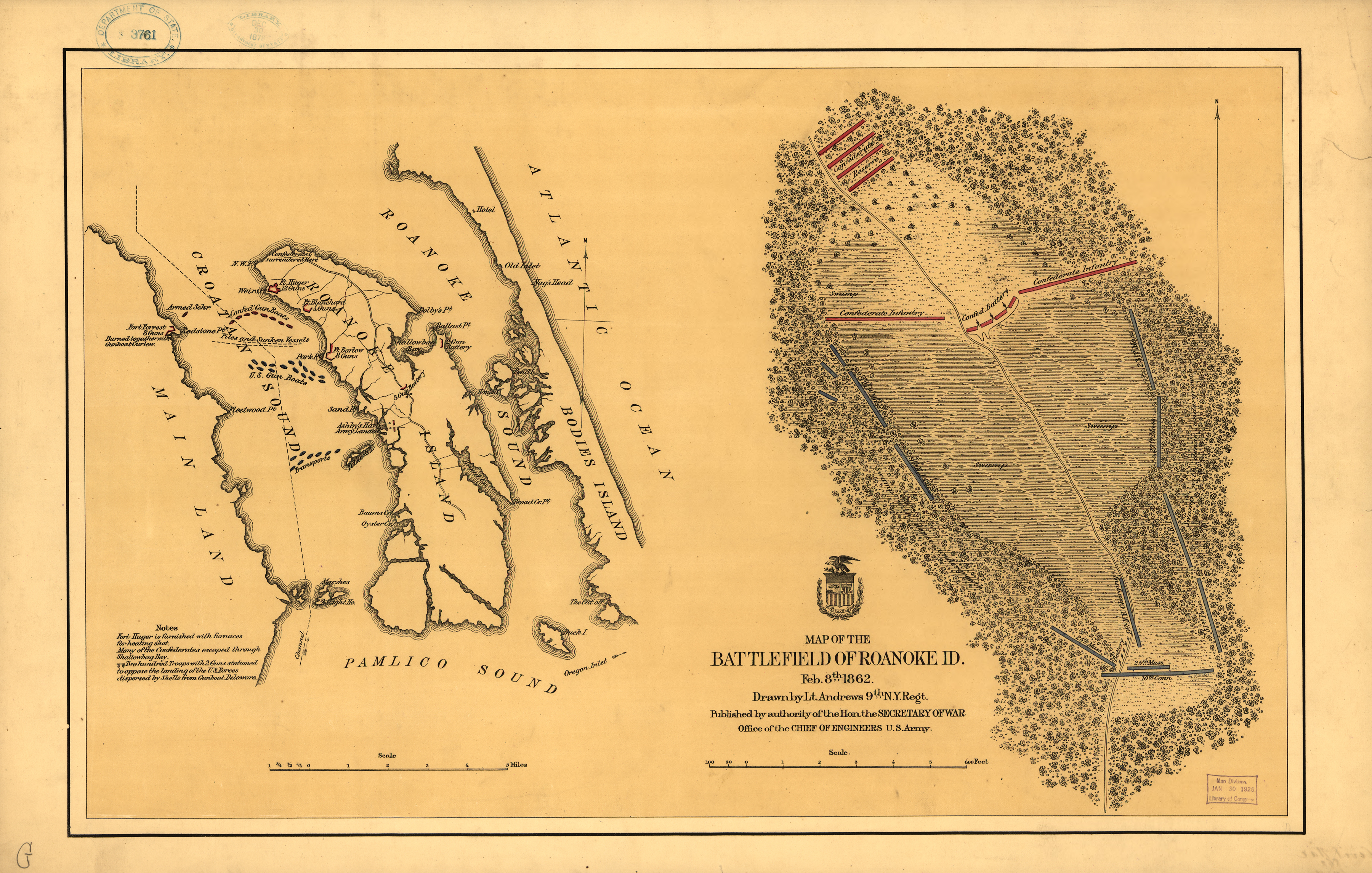
English: Maps of Roanoke Island and the battlefield on the island, showing Confederate defenses and attacking Union forces. Copied and reduced in size from Library of Congress.[1] |
| Date | |
| Source | United States Army |
| Author | Lt. Andrews, 9th N.Y. Regiment (not otherwise identified) |
| Permission (Reusing this file) |
Public domain - United States Government |
| Other versions |

Licensing
[edit]
This work is in the public domain in the United States because it is a work prepared by an officer or employee of the United States Government as part of that person’s official duties under the terms of Title 17, Chapter 1, Section 105 of the US Code.
Note: This only applies to original works of the Federal Government and not to the work of any individual U.S. state, territory, commonwealth, county, municipality, or any other subdivision. This template also does not apply to postage stamp designs published by the United States Postal Service since 1978. (See § 313.6(C)(1) of Compendium of U.S. Copyright Office Practices). It also does not apply to certain US coins; see The US Mint Terms of Use.
|
 | |
| This file has been identified as being free of known restrictions under copyright law, including all related and neighboring rights. | ||
File history
Click on a date/time to view the file as it appeared at that time.
| Date/Time | Thumbnail | Dimensions | User | Comment | |
|---|---|---|---|---|---|
| current | 18:51, 26 October 2009 | | 3,600 × 2,291 (6.8 MB) | Pkkphysicist (talk | contribs) | {{Information |Description={{en|1=Maps of Roanoke Island and the battlefield on the island, showing Confederate defenses and attacking Union forces. Copied and reduced in size from Library of Congress.[http://memory.loc.gov/cgi-bin/query/D?gmd:4:./temp/~a |
You cannot overwrite this file.
File usage on Commons
The following 2 pages use this file:
File usage on other wikis
The following other wikis use this file:
- Usage on en.wikipedia.org
- Usage on fr.wikipedia.org